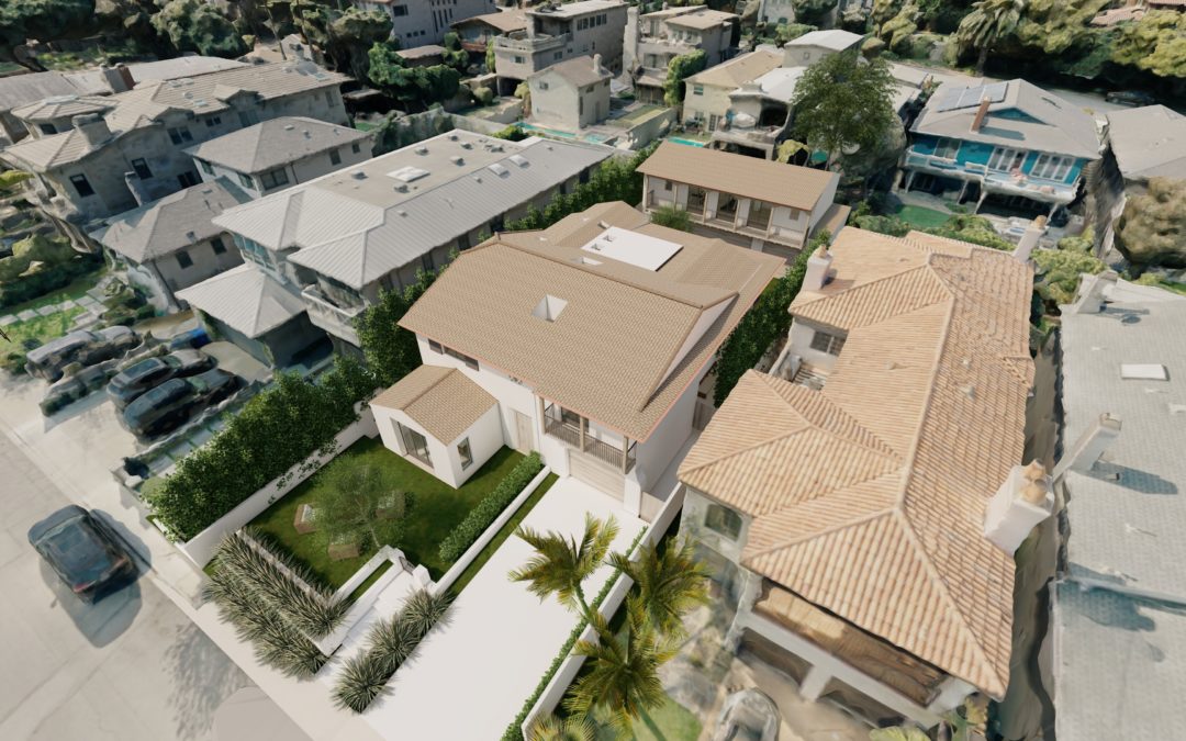
Architects Use 3D Modeling to Begin Designing and Help Sell Their Designs to Clients Photogrammetry software can create geo-referenced orthomosaics, elevation models, or 3D models of the project area. These maps can also be used to extract information such as...
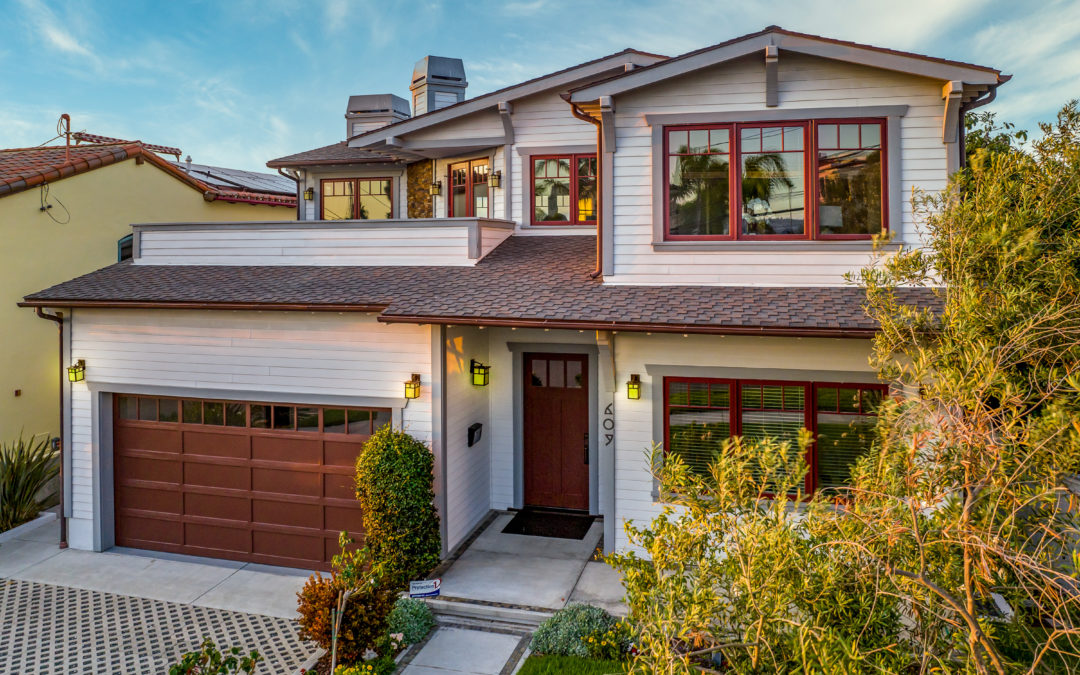
Stand Out in a Tight Market with Listing Photos that Show More Detail to Buyers With 96% of homebuyers making their purchasing decisions online, your listing needs to ramp up and grab their attention right away. Generate more clicks that turn into showings and solid...
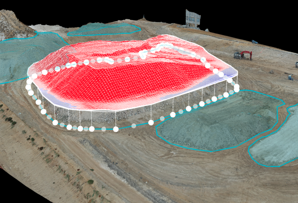
From Mapping to Stockpile Analysis, Drones Give You the Data You Need to Keep Stakeholders up to Date Construction site drone photography reduces risk factors, increases profitability, saves time, and collects a large amount of data that traditionally is...
With a drone, you can put the camera anywhere Need that perfect shot? Drones can offer multiple vantage points that just can’t be gotten without renting a helicopter. And who can afford that? We provide smooth coverage in 4k video that will meld perfectly with the...
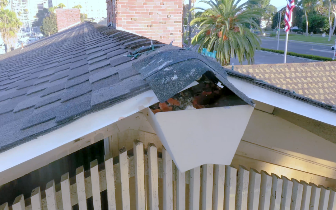
Why Drones Are Better for Rooftop Inspections From residential rooftops to utility-scale power plants, a drone can do an inspection in less time, with more data, and in a much safer way. That’s true whether on a rooftop or on the ground.