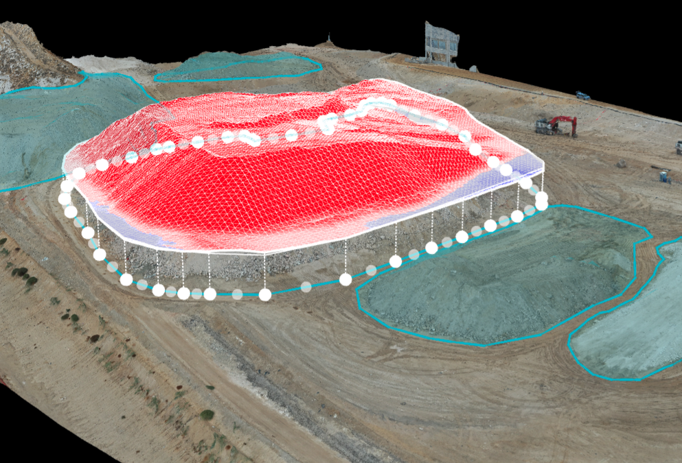
Find Out Exactly How Much Dirt is There Drones are a popular and conventional method of stockpile measurements in the industry. Our pilots can conduct stockpile analysis with our surveying drones and capture topographic data points that traditional methods cannot...
Stand Out in a Tough Market with Listing Photos that Show More Detail to Buyers With 96% of homebuyers making their purchasing decisions online, your listing needs to ramp up and grab their attention right away. Generate more clicks that turn into showings and solid...
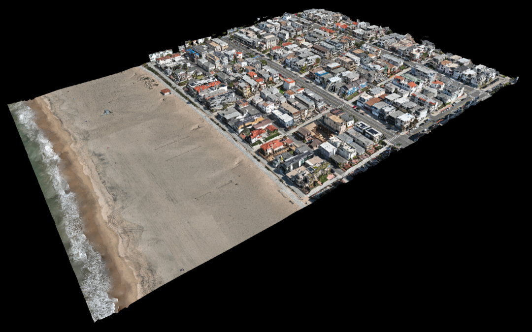
We Turn a Thousand Pictures into One Clear, Undistorted, High-Resolution Photo Drones provide data for 3D creations and 2D orthomosaic maps of any location. Our software allows data, including contours and terrain, to be systematically captured, updated, and collected...
Tell a Thousand Words in One Photo With so much riding on collecting precise data, choosing the best tools for your case is essential. Drones are another tool that enables attorneys to become better visual storytellers in the courtroom. And often, when tools are...
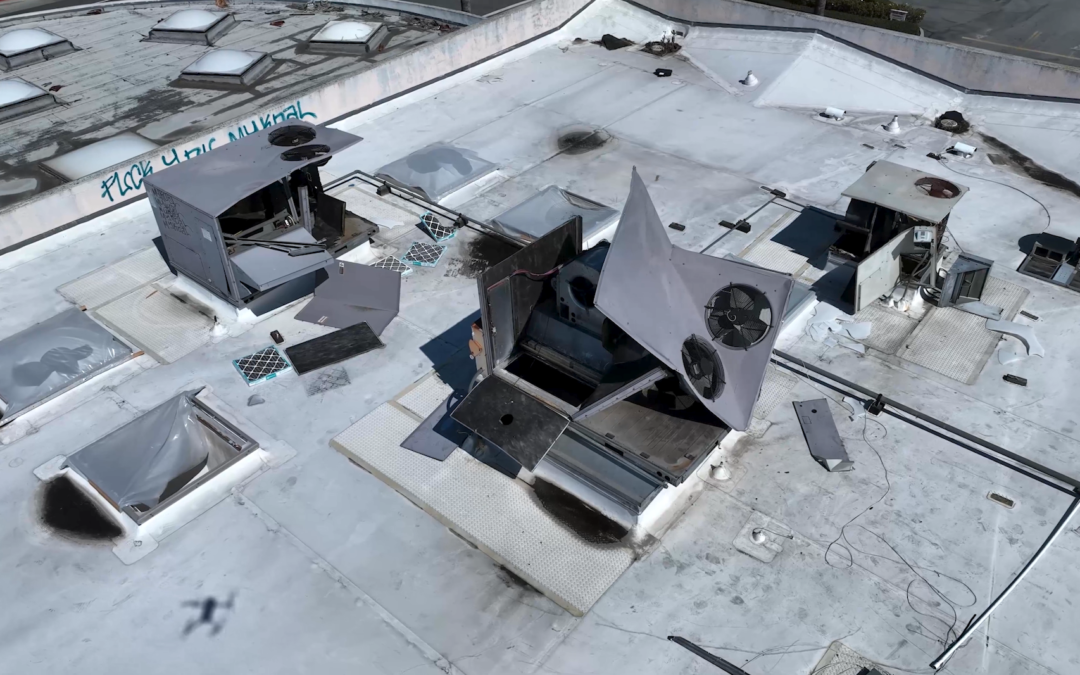
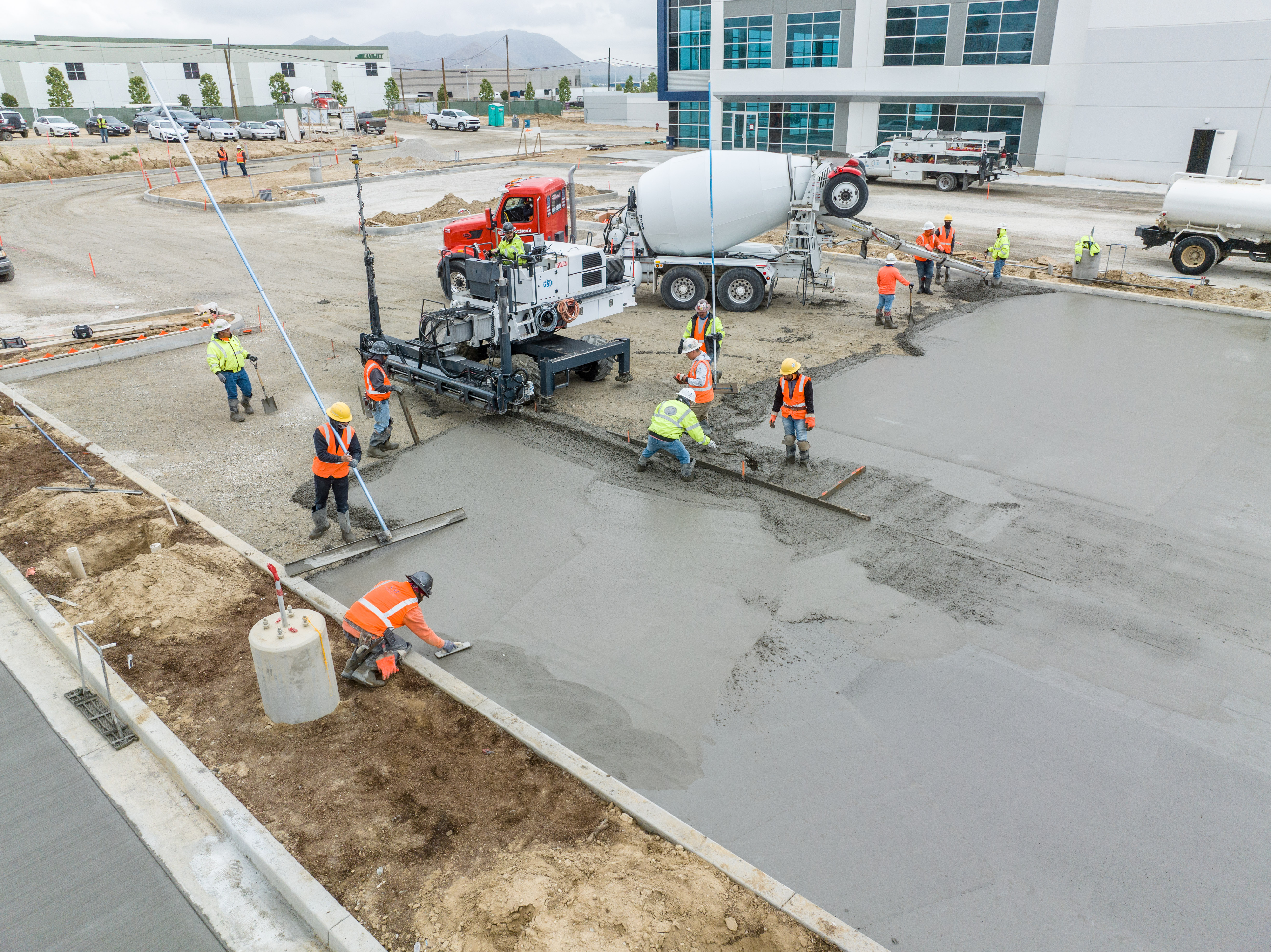
Show Everyone What’s Going on Without Being There Construction site drone photography reduces risk factors, increases profitability, saves time, and collects a large amount of data that traditionally is time-consuming to collect and often incomplete. Photos, videos,...
Put Our Camera There or There or Anywhere Drones capture stunning, high-quality footage. Drones can now shoot and record full HD and up to 4K video resolution. Our drones have a gimbal with three-axis stabilization, allowing them to capture smooth video footage while...