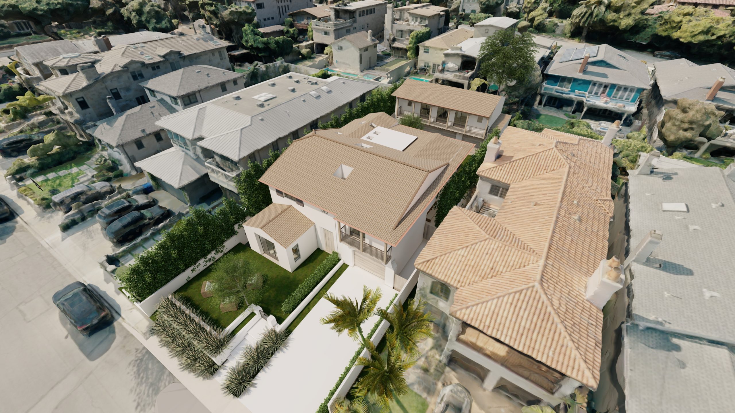
Drones have become increasingly popular in various fields, including architecture. They offer a unique perspective that allows architects to capture detailed imagery of residential neighborhoods and create accurate 3D models. This case study explores how drones can be useful in creating 3D models of residential neighborhoods and how architects can use these models to show clients what the new house design would look like in the real 3D environment it will be located in.
The Challenge:
When designing a new residential home, architects must consider many factors, including the environment in which the home will be located. This includes the surrounding buildings, topography, and other features that may affect the design and aesthetics of the new home. Traditionally, architects would rely on official surveys and photographs to assess these factors, which can be time-consuming. With the advent of drone technology, Southbay Drone Services now has the ability to capture detailed aerial imagery and create accurate 3D models of the surrounding environment.
The Solution:
To create a 3D model of a residential neighborhood, Southbay Drone Services uses a drone equipped with a high-resolution camera. The drone can fly over the neighborhood, capturing detailed images of the buildings, terrain, and other features. The images can then be processed using photogrammetry software to create a 3D model of the neighborhood. The resulting model can be imported into 3D modeling software and combined with the new house design to visually represent how the new home will look in its real 3D environment.
Benefits:
Using drones to create 3D models of residential neighborhoods offers several benefits for architects and their clients. First, it allows architects to capture detailed data of the surrounding environment, which can inform the design of the new home. For example, if nearby buildings may obstruct views from the new home, the architect can consider that when designing the home. Second, it provides clients with a visual representation of how the new home will look in its real 3D environment. This can help clients better understand how the new home will fit into the neighborhood and make informed decisions about the design.
Conclusion:
Drones have revolutionized how architects design residential homes by providing a new perspective on the surrounding environment. By using drones to create 3D models of residential neighborhoods, architects can better understand the new home’s environment and create a virtual representation of how the new home will look in its real 3D environment. This technology offers many benefits for architects and their clients and is becoming an increasingly important tool in the architecture industry.

