Introduction:
In the construction industry, earthworks play a vital role in shaping the foundation of a project. Precise measurements and accurate mapping are crucial for ensuring that the earthworks are executed correctly. Traditional surveying methods can be time-consuming and labor-intensive, often leading to delays and potential inaccuracies. However, the advent of drone technology has revolutionized the construction industry, offering a more efficient and accurate solution. This case study explores how the use of drones for orthomosaic mapping improved earthworks and brought significant benefits to a construction project.
The Challenge:
KPRS, a construction company undertaking a large-scale infrastructure project, faced the challenge of accurately measuring and mapping extensive earthworks. The site encompassed vast areas, making traditional surveying methods impractical and time-consuming. The company needed a solution that could provide precise measurements, detailed topographic information, and a comprehensive understanding of the project site, all while minimizing time and resources.
The Solution:
KPRS decided to incorporate drone technology and orthomosaic mapping into their earthworks process. They employed Southbay Drone Services who are well-versed in aerial mapping techniques. The process involved the following steps:
- Drone Deployment: Southbay Drone Services deployed drones equipped with high-resolution cameras to capture aerial images of the project site. These drones were programmed to follow pre-defined flight paths, ensuring comprehensive coverage and optimal data collection.
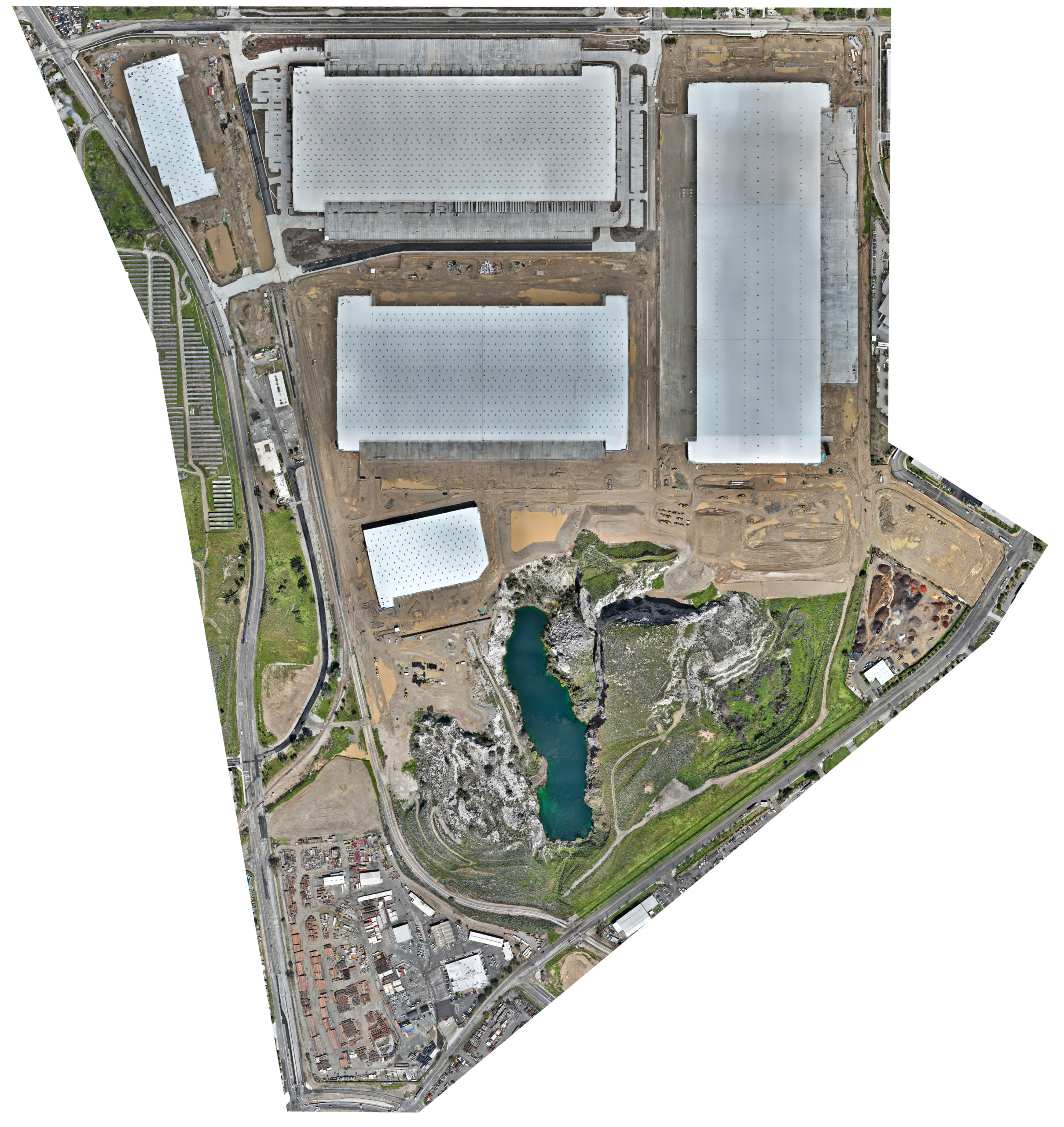
- Data Capture and Processing: The images captured by the drones were processed using specialized software to create detailed orthomosaic maps. This process involved stitching multiple images together, rectifying distortions, and generating accurate digital elevation models (DEMs) and 3D point clouds.
- Analysis and Measurement: The orthomosaic maps, DEMs, and 3D point clouds were analyzed to extract precise measurements and topographic information. The construction team could then assess cut and fill volumes, slopes, contours, and other critical earthwork parameters.
- Integration with BIM: The orthomosaic maps were integrated with the project’s Building Information Modeling (BIM) software, providing a comprehensive overview of the earthworks in relation to the entire project. This integration facilitated effective decision-making, improved collaboration, and reduced potential clashes between different project elements.
Benefits:
The adoption of drones for orthomosaic mapping yielded several notable benefits for the construction company:
- Time and Cost Savings: The use of drones significantly reduced the time required for earthwork surveys. With swift aerial data collection and automated processing, the construction team could access accurate measurements and topographic information promptly. This time savings translated into cost savings, as fewer resources were needed for surveying activities.
- Enhanced Accuracy and Precision: The drone-captured orthomosaic maps provided a detailed and accurate representation of the project site. Precise measurements, cut and fill calculations, and 3D visualization helped minimize errors and discrepancies during the earthworks phase.
- Improved Safety: By deploying drones, the construction company could minimize the need for manual surveying on potentially hazardous terrains. This reduction in on-site personnel decreased the risk of accidents and improved overall safety conditions.
- Streamlined Decision-Making: The integration of orthomosaic maps with BIM software allowed for better coordination and collaboration among various project stakeholders. It enabled informed decision-making based on up-to-date and accurate visual data.
Conclusion:
The case study clearly demonstrates the benefits of using drones for orthomosaic mapping in earthworks within the construction industry. By leveraging this technology, KPRS achieved substantial time and cost savings, enhanced accuracy, improved safety, and streamlined decision-making processes. The combination of drone technology, orthomosaic mapping, and integration with BIM proved to be a powerful solution for overcoming the challenges of earthworks in construction.

