Introduction:
Architectural design relies on accurate measurements and site data, which are traditionally obtained through official surveys. However, waiting for these surveys can introduce delays and hinder the design process. This case study explores how Brett Buchmann Design, an architect in the Southbay, overcame this challenge by utilizing 3D modeling created with drone services provided by Southbay Drone Services. This approach allowed Brett Buchmann Design to begin designing without having to wait for the official survey, as the drone-collected elevation data proved to be accurate enough.
The Challenge:
Brett Buchmann Design faced the challenge of commencing the design process for a new house while waiting for the official survey. This delay had the potential to impact project timelines and slow down the design phase. The challenge was to find a solution that allowed him to start designing without compromising accuracy and efficiency.
The Solution: To address the challenge, Brett Buchmann Design collaborated with Southbay Drone Services to leverage their expertise in drone technology and data collection. The following steps were taken to incorporate drone-created 3D modeling into the design process:
- Engagement with Southbay Drone Services: Brett Buchmann Design partnered with Southbay Drone Services, a professional drone service provider. Southbay Drone Services deployed licensed drone operators equipped with high-resolution cameras to capture detailed aerial images and elevation data of the project site.
- Drone Data Collection: The drone operators flew the drones over the project site, capturing comprehensive aerial images and elevation data. The high-resolution images and data provided accurate measurements and topographic information, eliminating the need to wait for the official survey.
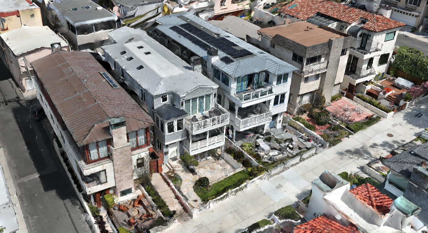
- Data Processing and 3D Modeling: The collected drone data was processed using specialized software to generate accurate 3D models of the project site. The software stitched together the aerial images, rectified distortions, and created detailed digital elevation models (DEMs) and 3D point clouds.
- Integration with Design Software: The 3D models created from the drone data were seamlessly integrated into architectural design software. Brett Buchmann Design could then overlay their design concepts onto the 3D models, allowing for realistic visualization of the proposed house within the existing environment.
Benefits:
The adoption of drone-created 3D modeling provided several significant benefits for Brett Buchmann Design and the design process:
- Time and Efficiency: By utilizing drone-collected elevation data, Brett Buchmann Design could commence the design process promptly, eliminating the need to wait for the official survey. This accelerated the design phase, reduced project timelines, and improved overall efficiency.
- Accuracy and Precision: The drone-collected elevation data provided precise measurements and topographic information, enabling him to ensure accurate placement, integration with the environment, and adherence to zoning regulations.
- Realistic Visualization: Integrating the 3D models into design software allowed for realistic visualization of the proposed house within the existing site. This visualization facilitated better decision-making, improved communication with clients, and enhanced stakeholder engagement.
- Cost Savings: By starting the design process earlier, Brett Buchmann Design could identify and address potential design issues or conflicts at an early stage, reducing the need for costly design revisions later in the project.
Conclusion: This case study demonstrates the benefits of leveraging drone-created 3D modeling to jumpstart the architectural design process. By utilizing accurate elevation data collected by drones, Brett Buchmann Design was able to commence designing a new house without having to wait for the official survey. This approach significantly improved efficiency, accuracy, and visualization, resulting in better project outcomes. Incorporating drone technology into the architectural design process empowers architects to deliver innovative designs in a timely and cost-effective manner.

