Introduction:
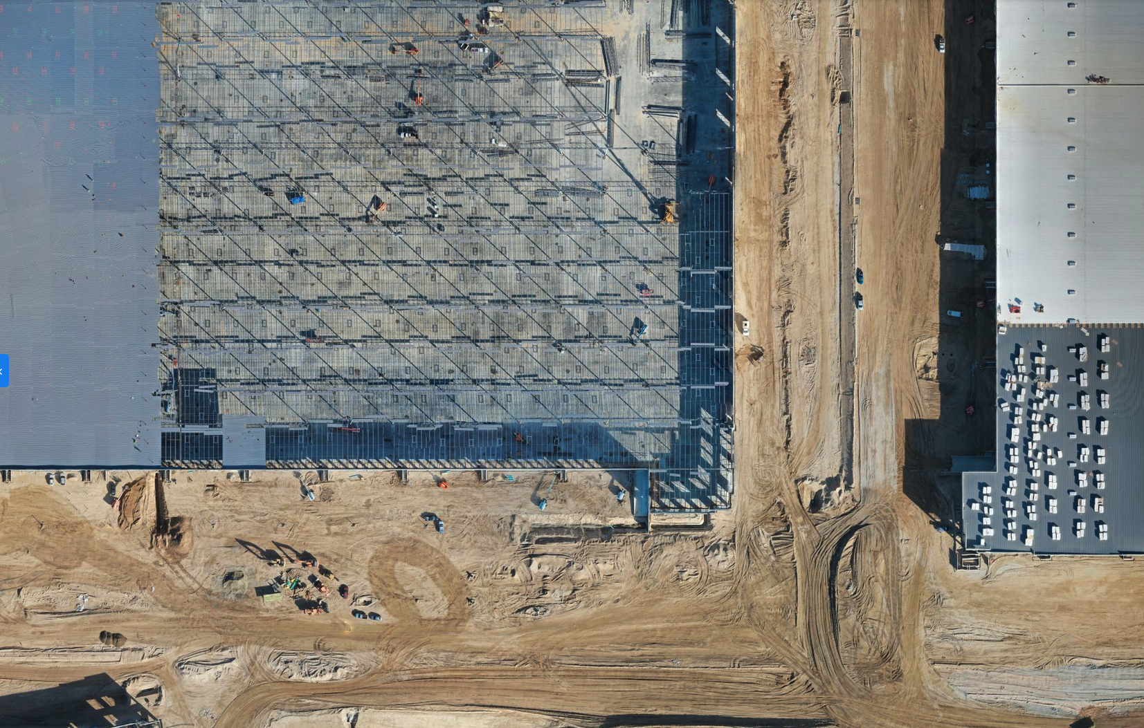
In the world of commercial construction, staying ahead of the game and maximizing efficiency are key to successful project completion. With advancements in drone technology, companies like Southbay Drone Services offer an invaluable service for construction companies—creating accurate orthomosaic maps of construction sites. In this article, we explore the top five reasons why commercial construction companies should consider utilizing orthomosaic maps for their construction sites.
- Accurate Site Documentation and Planning:
Southbay Drone Services can capture high-resolution aerial imagery of construction sites, providing detailed and accurate orthomosaic maps. These maps serve as an essential tool for site documentation and planning. Construction companies can use the orthomosaic maps to visualize the entire site, identify potential challenges, and make informed decisions based on precise measurements and topographic data. This level of accuracy allows for improved site planning, streamlined workflows, and efficient resource allocation.
- Real-Time Progress Tracking:
Orthomosaic maps created by Southbay Drone Services enable construction companies to track project progress in real time. By capturing periodic updates of the construction site, the maps provide an up-to-date visual representation of the project’s advancement. Construction managers can compare the orthomosaic maps with initial designs and plans, ensuring that the construction aligns with the intended vision. Real-time progress tracking helps identify any deviations from the plan early on, allowing for prompt adjustments and proactive decision-making.
- Enhanced Communication and Collaboration:
The use of orthomosaic maps facilitates effective communication and collaboration among project stakeholders. Construction companies can easily share the maps with architects, engineers, subcontractors, and clients, providing a comprehensive overview of the site. This visual representation promotes clear communication, allowing all parties to better understand the project’s scope and requirements. With a shared reference point, collaboration becomes more efficient, leading to improved coordination, minimized errors, and enhanced project outcomes.
- Improved Safety and Risk Management:
Orthomosaic maps offer valuable insights into safety and risk management on construction sites. By analyzing the maps, construction companies can identify potential hazards, evaluate site accessibility, and plan safety measures more effectively. The detailed visualization helps assess potential risks and develop strategies to mitigate them. With this proactive approach to safety, construction companies can create a safer work environment, reduce accidents, and minimize project delays associated with unforeseen risks.
- Cost and Time Savings:
Utilizing Southbay Drone Services for orthomosaic mapping can lead to significant cost and time savings. The accurate documentation of the construction site allows for more precise project planning and resource allocation. The ability to track progress in real time helps identify potential delays or issues early on, allowing for timely intervention. By streamlining communication, collaboration, and safety measures, construction companies can optimize their workflows, reduce rework, and complete projects within budget and on schedule.
Conclusion:
The benefits of utilizing Southbay Drone Services for orthomosaic mapping in commercial construction are undeniable. From accurate site documentation and real-time progress tracking to enhanced communication, improved safety, and cost savings, the use of orthomosaic maps revolutionizes construction project management. By harnessing the power of aerial imagery and advanced mapping technology, construction companies can streamline their processes, make informed decisions, and achieve successful project outcomes. Embracing drone technology for orthomosaic mapping is a game-changer for the construction industry, propelling it towards greater efficiency and innovation.

