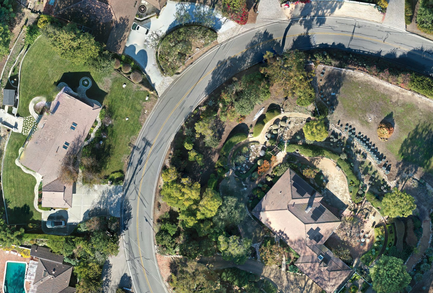
Architects play a crucial role in creating functional and visually appealing structures. To achieve success in their projects, architects need accurate and timely information about the site and its surroundings. Traditional survey methods can be time-consuming and may cause delays in the design process. However, by hiring Southbay Drone Services to create an orthomosaic map, architects can obtain valuable elevation data quickly, allowing them to commence the design phase without waiting for the completion of the official survey months down the road. In this article, we explore the advantages of leveraging orthomosaic mapping services provided by Southbay Drone Services for architectural design.
- Timely Access to Accurate Elevation Data:
One of the primary benefits of hiring Southbay Drone Services for orthomosaic mapping is the ability to obtain accurate elevation data in a timely manner. Drones equipped with high-resolution cameras capture detailed aerial imagery, which is processed to create a precise orthomosaic map of the site. This map provides architects with valuable elevation information, including contours, topography, and other critical data points. Having access to such accurate data at an early stage enables architects to kickstart the design process promptly, without having to wait for the completion of a time-consuming traditional survey.
- Design Optimization and Efficiency:
By utilizing an orthomosaic map generated by Southbay Drone Services, architects can optimize their designs with greater efficiency. The detailed elevation data allows architects to assess the terrain, identify potential challenges, and make informed design decisions. It enables them to create designs that harmoniously integrate with the site’s existing features and natural landscape. By leveraging the orthomosaic map, architects can save significant time and effort that would otherwise be spent on multiple site visits and subsequent design adjustments.
- Enhanced Visualization and Collaboration:
The detailed orthomosaic map provided by Southbay Drone Services enhances the visualization capabilities for architects. It offers a comprehensive and detailed overview of the site, enabling architects to visualize their designs within the context of the real-world environment. This visual representation facilitates better communication with clients, stakeholders, and construction teams, promoting collaborative decision-making and alignment on project goals. The orthomosaic map acts as a valuable visual aid, helping all parties involved gain a clear understanding of the project’s scope and potential challenges.
Conclusion:
Incorporating drone-based orthomosaic mapping services offered by Southbay Drone Services in the architectural design process offers architects numerous benefits. Timely access to accurate elevation data, design optimization, cost and time savings, and enhanced visualization and collaboration are among the advantages of leveraging this technology. By utilizing orthomosaic maps, architects can commence their designs promptly, bypassing the waiting period associated with traditional surveys. This innovative approach empowers architects to create well-informed, efficient, and visually appealing designs while streamlining project timelines and improving client satisfaction. By partnering with Southbay Drone Services, architects can unlock the potential of orthomosaic mapping and revolutionize their design process.

