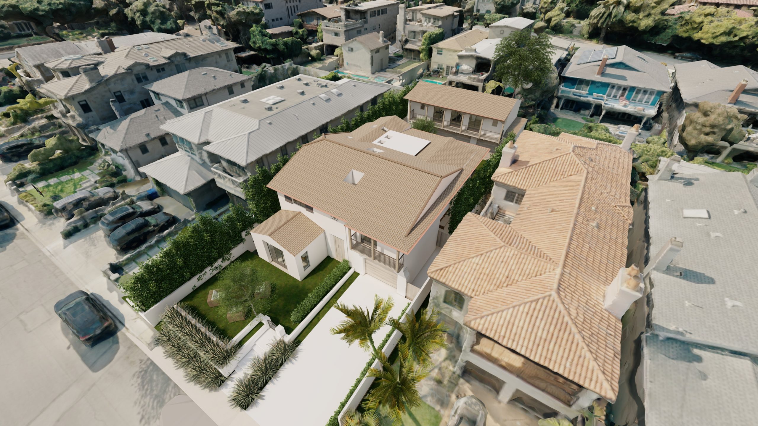
Architects constantly seek innovative ways to present their designs to clients in a manner that is both captivating and accurate. Traditional 2D renderings and blueprints, while valuable, can sometimes fall short in conveying the full vision of a project within its real-world context. However, with the advent of drones and the expertise of SouthBay Drone Services in creating 3D orthomosaic maps, architects can now harness the power of accurate 3D models to showcase their designs within the surrounding neighborhood. In this article, we explore how architects can leverage these cutting-edge technologies to provide clients with a truly immersive and realistic visualization experience.
Accurate and Detailed Representation:
Drones equipped with high-resolution cameras can capture precise aerial imagery of neighborhoods, allowing SouthBay Drone Services to create 3D orthomosaic maps. These maps provide architects with an accurate and detailed representation of the surroundings, including buildings, roads, landscapes, and other elements. By incorporating these 3D models into design presentations, architects can offer clients a holistic view of how their project will fit into the existing environment. This level of accuracy fosters better understanding and helps clients visualize the final design with greater clarity.
Realistic Visualization:
The use of 3D orthomosaic maps enables architects to provide clients with a realistic and immersive visualization experience. Clients can see their proposed design within the context of the surrounding neighborhood, enhancing their comprehension of scale, proportion, and spatial relationships. This realistic visualization bridges the gap between the abstract concepts presented in traditional renderings and the tangible reality of the built environment. It helps clients connect emotionally with the design, fostering a stronger sense of confidence and excitement about the project.
Design Iteration and Optimization:
The use of 3D models derived from drone-captured orthomosaic maps empowers architects to iterate and optimize their designs more effectively. Clients can easily comprehend the proposed changes within the context of the neighborhood, allowing for faster feedback and more informed design revisions. The ability to visualize multiple design options in a realistic environment helps clients make confident decisions about their project. This iterative process results in designs that align closely with client expectations and enhances overall project satisfaction.
Conclusion:
Incorporating 3D orthomosaic maps created by SouthBay Drone Services into architectural design presentations unlocks a new level of visual communication and understanding. Architects can showcase their designs within the accurate 3D world of the surrounding neighborhood, providing clients with immersive and realistic experiences. By leveraging this technology, architects enhance communication, foster collaboration, optimize design iterations, and ultimately deliver projects that align closely with client expectations. The use of 3D models derived from drone-captured orthomosaic maps revolutionizes design presentations, offering architects a powerful tool to convey their vision and transform the way clients perceive and engage with architectural designs.

